2005 ESRI Map Gallery Contest winner with Ideal Locations for Wind Turbines GIS project published.
Beetle Infestation GIS/Mapping Project for the Ministry of Forests, Lands and Natural Resource Operations.
Agricultural Land Use Inventory GIS Project for the Pacific Agri-Food Research Centre.
Sensitive Ecosystem Ranking GIS Project with Geostream Environmental Consulting for the Okanagan Basin Water Board (OBWB).
Various Recreation Site Plans and Brochures for Recreation Sites and Trails, BC.
Street Map Book guides for Info-Tel Multimedia, Salmon Arm Observer and the Morning Star.
Parcel Fabric Topology creation & successful migration to GIS Functionality for the Regional District of North Okanagan (RDNO).
CAD to ArcGIS spatial transformation of OCP data to match current parcel fabric for the City of Cranbrook.
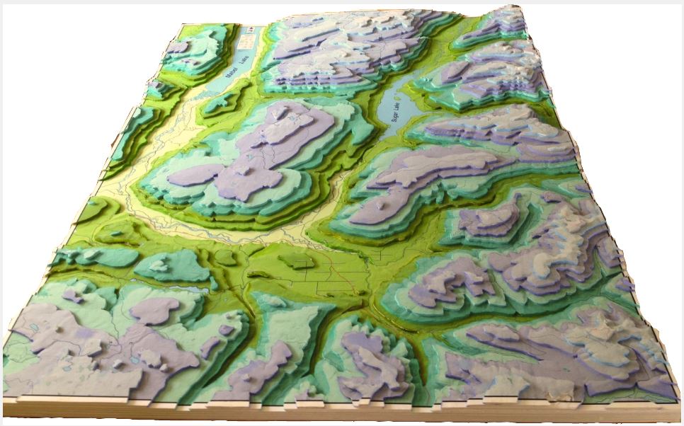
3D Terrain Model layered at 200m elevation increments using foamboard for the Cherryville Water Stewards.
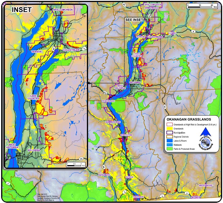
Grasslands at Risk in Southern BC GIS Project and Brochures for the Grasslands Conservation Council of BC
ESRI's Do-It-Yourself Geo App certificate on how to combine location and narrative in custom built apps for the web, computers and for IOS and Android devices.
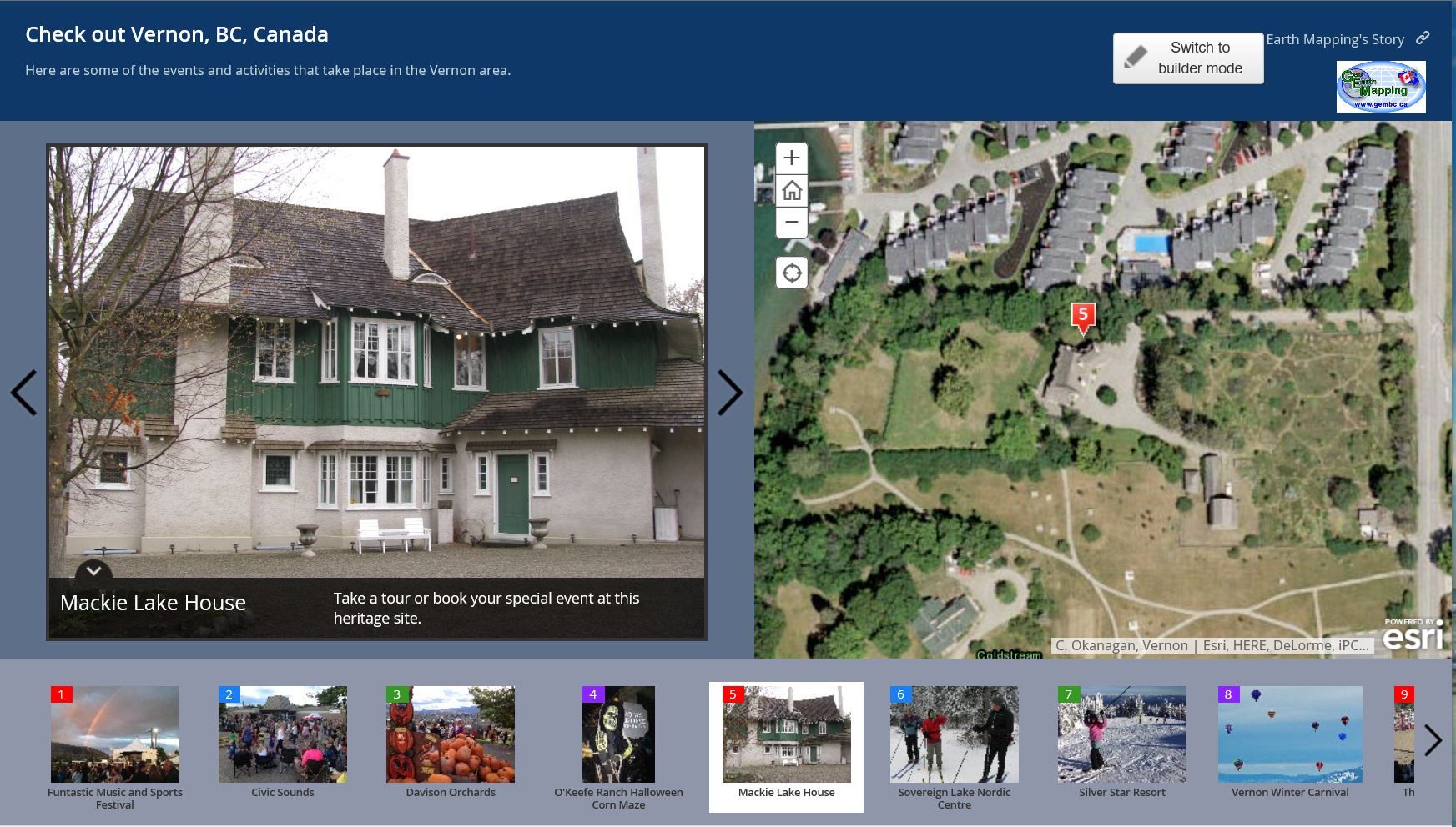
Story Map Example (Vernon's Attractions)
Grasslands at Risk to Development in the Okanagan Region.
3D Terrain Model of the Cherryville Watershed Area
We also do conversions to KML/KMZ for viewing in Google Earth ...and create geo-referenced digital data for tenure applications and PDF maps for mobile apps..